Panhandle Creek Trail

Wednesday July 20, 2011

The Panhandle Creek Trail is close to our house in Crystal Lakes. It is not on any trail maps we could find but was recommended by Steve at Lone Pine Realty. We did not have any idea how long or hard it was but was very presently surprised. We were on a rest day (not sure what Mom and Dad mean by rest day we still hike and I still run and swim until my legs are tired all over again) and had a very nice 4 mile out and back hike along Panhandle Creek.

Panhandle Trailhead

Panhandle Creek

Lots of wildflowers on this trail

A 'shroom

Columbine

A good stretch

Blue Lake Trail

Monday July 18, 2011

We headed out to the upper Podure Canyon to find the Blue Lake Trail. Beginning elevation was 9400 feet and we turned at about 10,500 feet. Our total hike was our longest, 8 miles out and back.

The trail description from the Poudre Wilderness Volunteers:
The first 2 miles of the trail follows an old logging road and is in multi-use National Forest. Within the first 0.25 mile you will cross over Joe Wright Creek. About 1.5 miles from the trailhead there is a small rise to the east with a nice overlook that offers glimpses of Chambers Lake. You will enter the Rawah Wilderness shortly after crossing a footbridge over Fall Creek. After another 2 miles, you reach a meadow and a log bridge crossing the north branch of Fall Creek.

Trailhead

Off we go!

We were hiking in the Rawah Wilderness

A 2 miles we crossed the foot bridge at Fall Creek

Fall Creek

Fall Creek

Dad took a sit at Fall Creek

Mom is eating a power bar honest!

And off we went.

There was snow along the way.

About 4 miles in we crossed a beautiful meadow where we stopped and took a breath

The meadow was a good spot to get a picture of Mom and Dad

At 5 miles we reached a little log bridge and so much snow on the other side we could not find the trail. We were pretty tired anyway and had 5 miles to go back.

Did I tell you I like the water?

I know I was tired. I took a rest while Mom and Dad had a bite of lunch.

Avalanche Lilly

A short rest on the return at Fall Creek

Fall Creek

All done, 10 miles!!!

After the hike we drove to Cameron Pass (10,249 ft) a bit further west on Highway 14. Some beautiful scenery but no moose to be seen.

Mt Richthofen 12,940 ft

Big South Trail

Wednesday July 13, 2011

This hike was really something. Dad says it was his favorite. The trail winds its way up the east side of the Cache La Poudre River. What made this really exciting was the river. I understand that this year in Colorado there was a lot more snow than normal and then the heat began suddenly increasing the run off in the rivers like the Poudre to record levels. As we walked along the river I could not hear Dad or Mom unless they yelled over the roar of the river. They seemed worried that I might go in too far and get swept to Ft. Collins but I am a dog I am not stupid, I was very careful.

Big South Trail Elevation

The trail is maintained by the Poudre Valley Health Care System

Trail Description from http://www.poudrewildernessvolunteers.org
This trail starts in multi-use National Forest, but after only 0.5 mile, you enter the Comanche Peak Wilderness and the Big South Travel Zone.

We entered the Wilderness

The trail winds its way up the east side of the Cache La Poudre River for about 6.5 miles, where it is intersected by the Flowers Trail coming down from the east. See the description for the upper portion of this trail under the Corral Creek and Upper Big South Trails description.

There are 16 designated campsites situated along the trail in the Big South Travel Zone. The first five campsites are located on the slope above the trail, starting about 0.75 mile in.

Campsite 1

Mom really like Campsite 4.

Site #6 is located just before crossing the bridge over May Creek about 2 miles from the trailhead. Site #7 is located uphill shortly after crossing May Creek. Campsite #8 is located about 0.75 mile further uphill and to your left.

We went past campsite 7 trying to find campsite 8. Found out later that the sign for 8 is missing.

We hiked to campsite 8 before turning around.

The Poudre River was really running. At times mom and dad had to yell at me for me to hear them over the river noise.

There were great wildflowers along the trail

You know if we were near the river I needed to swim. Mom and Dad were worried I would go in to far and get swept to Ft. Collins. I am a dog not stupid. I was really careful.

Mom and Dad!

What a river!

The trail crosses a big rock slide area. I started and slipped a bit.

So Mom put me on a leash so i would not fall.

Swimming again!

Dad

We took a little break when we crossed creek bridge.

We took a break when we turned around. A deer came walking buy.

Another great hike.

We hiked Big South again on Thursday the 28th with Alex.

Alex in the lead

Mom and Alex hiking together

A Mom and her Son

Just had to get into the water.

The Poudre was not as high as the last time but still a powerful river.

There were different wildflowers this time.

I really like the Big South Hikes!!

Kreutzer Nature & Mt. McConnel Trail

July 11, 2011

We headed to the Lower Poudre Canyon to the Kreutzer and Mt McConnel trails. It is a combination of two trails. The Kreutzer Nature trail is a loop and the trail to the summit of Mt McConnel can be done as an out and back or look to the summit off the nature trail.

Nature and McConnel Trail head sign

Trail Description by http://www.poudrewildernessvolunteers.org
This trail system was constructed by the Civilian Conservation Corps (CCC) in 1936 during the Depression and was named after William Kreutzer, who was the first official forest ranger in the U.S., in the 1890s. Mt. McConnel was named after R.C. McConnel, one of the first rangers in the Poudre District, who served here in the early 1900s. The Kreutzer Nature Trail has at least 23 interpretative signs along its length that provide information about local geology, ecology, plants, and animals.

Mt McConnel Elevation

The trail makes several switchbacks, then turns and climbs gradually westward paralleling the campground. After 0.4 mile, it will makes a sharp left (east) turn and climbs another 0.4 mile to the high point of the Kreutzer Nature Trail, where the west end of the Mt. McConnel Trail starts. To continue your patrol of the Mt. McConnel Trail follow the Mt. McConnel Trail uphill. Look for several cleverly constructed rock benches and seats that offer respite and great views. These were built right into the mountain slopes supposedly by the CCC. There is a great view to the north from the trail where it switches back just below an impressive rock escarpment and extensive talus slope about 1.4 mile from the trailhead. From this point, the trail continues climbing steeply and passes several more rock benches and seats built by the CCC. About 0.75 miles above the junction with the Kreutzer Nature Trail, the Mt. McConnel Trail enters the Cache la Poudre Wilderness (1.6 miles from the trailhead). (This is the only official trail in this Wilderness.) After another 0.25 mile, look carefully to the west, along the right side of the trail, for the unmarked 0.14 mile-long spur trail to the summit (approx. 1.9 miles from the trailhead). From the summit there is a great view to the southwest of the canyon carved by the South Fork of the Cache La Poudre River and beyond it, on the horizon, you can see the Mummy Range. To the west you can see a stretch of the Pingree Park Road.

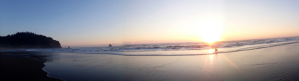
View of the Poudre River

We entered the only Trail in the Cache la Poudre Wilderness

The nature trail on the way up

Now those are some legs!

Where the Mt McConnel trail leaves the Nature trail

Mt McConnel summit

View of the Rocky Mountain National Park

Mom and Dad on the summit of McConnel

I took a rest on the summit

Mt McConnel Summit. That was the Rocky Mountain National Park we could see.

Mom takes one more look at Rocky Mountain National Park

Mt. McConnel primitive trail by http://www.poudrewildernessvolunteers.org

If you are feeling ambitious at the summit, and are a strong hiker, you can take the spur trail back to the main Mt. McConnel Trail and turn right, to the southeast. The east arm of the Mt. McConnel Trail is steep, primitive, and not often used. You will eventually rejoin the Kreutzer Nature Trail. At this point you can go either of two routes back to Mountain Park Campground. You can follow the Kreutzer Nature Trail uphill and to the west until you reach its junction with the west arm of the Mt. McConnel trail and then follow it (Kreutzer Nature Trail) downhill, retracing your path down to the trailhead. Alternately, you can follow the Kreutzer Nature Trail downhill and to the north and northwest as it contours around the northeast flank of Mt. McConnel and gently descends toward the Poudre River. This route will take you to the eastern terminus of the Kreutzer Nature Trail near the bridge across the Poudre.

We decided to return from the summit by way of the primitive trail.

The Talus Slope we crossed

View from the primitive trail on the way down

Killpecker Trail

Thursday July 7, 2011

This day brought us to the Killpecker Trail. What a name! We only drove a few minutes up Deadman Road, just past the Lone Pine trailhead. A beautiful hike along Killpecker Trail

The Poudre Wilderness Volunteers website describes the portion of the trail we hiked:
The first part of the trail heads steadily uphill through a mature, mixed lodgepole pine – Douglas fir forest along Killpecker Creek. There are two stream crossings in the first 1.5 miles. After 1.5 miles the trail passes through a logged-over area shortly before intersecting Killpecker Road (FDR-300). The trail can be picked up again down road and about 100 yards east of the stream. After a short but steady climb for about 0.3 mile, the trail will take you to a spring that provides the last source of water along the trail.

I really liked this trail.

Killpecker Creek

A log bridge across Killpecker Creek

If I look like I am being careful I am. I had just fallen off crossing this log. Good things Dogs don't get embarrassed.

Mom made it look easy!

I know I post a lot of wildflower pictures but there are so many and they are beautiful and smell good!

I think this is a Phlox. Does anyone else know?

A Lpine I believe

A boy and his dog.

A little water fall in Killpecker Creek

It seems like Dad always it taking pictures. I guess that is good or I would not have any to post here for you.

Dad is not the only one snapping pictures!

Parts of this trail were so green.

We turned around at the spring. I know there is a spring here but darn if I see it.